# Advanced Stop Line fields
| Name: | Advanced Stop Line |
| Geometry type: | LineString |
| Description: | Advance stop lines (ASL) located at traffic signals to provide an area for cyclists to wait for the traffic signals to change ahead of general traffic. The ASL reservoir is the area between the solid stop line, level with the signals, and the ASL for general traffic. The reservoir may have a coloured surface and have a cycle symbol in the centre. |
| Browse map: | Browse map |
| Fields: |
# Feeder Lane - asl_fdr
| Fieldname: | asl_fdr |
| Title: | Feeder Lane |
| Description: | True = Feeder lane present False = No feeder lane present (may be gate) |
| Data type: | ENUM('TRUE','FALSE') |
| combineOptionalField: | |
| Example ID: | RWG065830 |
| Clarifications: | Is drawn in a way which makes entirely clear which road this on, to the left of it |
| Convert geometry: | way->node, retain way |
| OSM tag(s): | node: cycleway=asl, TRUE: way: cycleway=lane |
| OSM comment: | OSM treats ASLs as a node, but the CID has them as a line. No tag for feeder lane exists yet, other than putting the lane on the adjacent highway |
| Action note: | Add node for ASL itself, and then when TRUE add cycleway=lane to way |
| query: | - |
| OSM Wiki page: | Tag:cycleway:asl |
| Documentation: | TfL documentation for asl_fdr |
| Example image: | 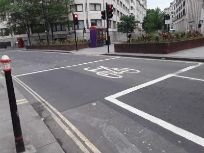 |
| Browse map: | Browse map |
# Feeder Lane in Centre - asl_fdcent
| Fieldname: | asl_fdcent |
| Title: | Feeder Lane in Centre |
| Description: | True = Feeder lane is in the centre of the Advanced Stop Line False = Feeder lane is not in the centre of the Advanced Stop Line |
| Data type: | ENUM('TRUE','FALSE') |
| combineOptionalField: | 1 |
| Example ID: | RWG065622 |
| Clarifications: | - |
| Convert geometry: | - |
| OSM tag(s): | TRUE: asl_position=center |
| OSM comment: | No such tag exists, so proposed tag here, and not necessary of significant use |
| Action note: | Community consultation needed for proposed new tag |
| query: | - |
| OSM Wiki page: | - |
| Documentation: | TfL documentation for asl_fdcent |
| Example image: | 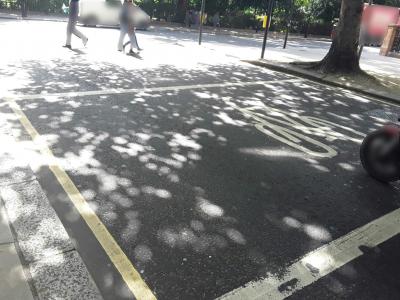 |
| Browse map: | Browse map |
# Feeder Lane on Right - asl_fdrigh
| Fieldname: | asl_fdrigh |
| Title: | Feeder Lane on Right |
| Description: | True = Feeder lane is aligned to far side of lane False = Feeder lane is not aligned to far side of lane |
| Data type: | ENUM('TRUE','FALSE') |
| combineOptionalField: | 1 |
| Example ID: | RWG065787 |
| Clarifications: | - |
| Convert geometry: | - |
| OSM tag(s): | TRUE: asl_position=right |
| OSM comment: | No such tag exists, so proposed tag here, and not necessary of significant use |
| Action note: | Community consultation needed for proposed new tag |
| query: | - |
| OSM Wiki page: | - |
| Documentation: | TfL documentation for asl_fdrigh |
| Example image: | 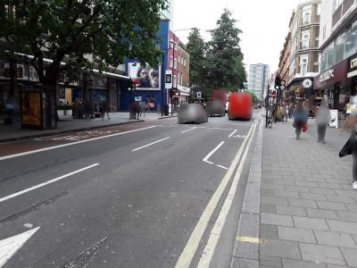 |
| Browse map: | Browse map |
# Feeder Lane on Left - asl_fdrlft
| Fieldname: | asl_fdrlft |
| Title: | Feeder Lane on Left |
| Description: | True = Feeder lane is aligned left next to kerb False = Feeder lane is not aligned left next to kerb |
| Data type: | ENUM('TRUE','FALSE') |
| combineOptionalField: | 1 |
| Example ID: | RWG065742 |
| Clarifications: | - |
| Convert geometry: | - |
| OSM tag(s): | TRUE: asl_position=left |
| OSM comment: | No such tag exists, so proposed tag here, and not necessary of significant use |
| Action note: | Community consultation needed for proposed new tag |
| query: | - |
| OSM Wiki page: | - |
| Documentation: | TfL documentation for asl_fdrlft |
| Example image: | 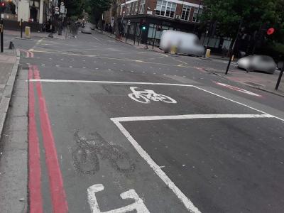 |
| Browse map: | Browse map |
# Colour - asl_colour
| Fieldname: | asl_colour |
| Title: | Colour |
| Description: | Colour of advanced stop line - Limited to only the following entries: None, Green, Red, Blue, Buff/Yellow, Other |
| Data type: | ENUM('NONE','GREEN','RED','BLUE','BUFF/YELLOW','OTHER') |
| combineOptionalField: | |
| Example ID: | RWG065832 |
| Clarifications: | - |
| Convert geometry: | - |
| OSM tag(s): | GREEN: surface:color=green RED surface:color=red BLUE: surface:color=blue BUFF/YELLOW: surface:color=yellow |
| OSM comment: | Taginfo suggests that surface:colour is least uncommon way to represent this, e.g. red is 4,388 cases worldwide: https://taginfo.openstreetmap.org/keys/surface:colour#values |
| Action note: | - |
| query: | - |
| OSM Wiki page: | Key:colour |
| Documentation: | |
| Example image: | 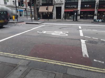 |
| Browse map: | Browse map |
# Shared Nearside Lane - asl_shared
| Fieldname: | asl_shared |
| Title: | Shared Nearside Lane |
| Description: | True = Shared nearside lane False = Not a shared nearside lane |
| Data type: | ENUM('TRUE','FALSE') |
| combineOptionalField: | |
| Example ID: | RWG065744 |
| Clarifications: | A shared nearside lane is where a cycle lane or shared bus lane becomes a lane for general traffic turning at a junction. |
| Convert geometry: | - |
| OSM tag(s): | - |
| OSM comment: | Essentially becomes the road, so no special infrastructure. |
| Action note: | Discard |
| query: | - |
| OSM Wiki page: | - |
| Documentation: | TfL documentation for asl_shared |
| Example image: | 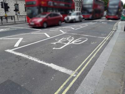 |
| Browse map: | Browse map |
# Crossing fields
| Name: | Crossing |
| Geometry type: | LineString |
| Description: | Crossings intended to be used by cyclists. Crossings may be located at road junctions or in the middle of road links, between junctions. This feature may include pedestrian-only crossings but only where they provide a link intended for cyclists to use between signed cycle routes (e.g. shared footways on both sides of the road or crossings over multi-lane, major or busy roads). |
| Browse map: | Browse map |
| Fields: |
# Signal-Controlled Crossing - crs_signal
| Fieldname: | crs_signal |
| Title: | Signal-Controlled Crossing |
| Description: | True = Controlled False = Uncontrolled (e.g. zebra) |
| Data type: | ENUM('TRUE','FALSE') |
| combineOptionalField: | |
| Example ID: | RWG065975 |
| Clarifications: | - |
| Convert geometry: | way->node |
| OSM tag(s): | highway=crossing TRUE: crossing=traffic_signals FALSE: crossing=uncontrolled |
| OSM comment: | - |
| Action note: | - |
| query: | - |
| OSM Wiki page: | Key:crossing |
| Documentation: | TfL documentation for crs_signal |
| Example image: | 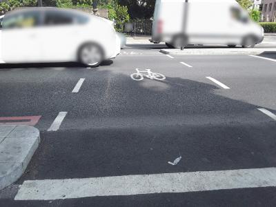 |
| Browse map: | Browse map |
# Pedestrian-Only Crossing - crs_pedest
| Fieldname: | crs_pedest |
| Title: | Pedestrian-Only Crossing |
| Description: | True = Cyclists must dismount to use False = Not a pedestrian-only crossing |
| Data type: | ENUM('TRUE','FALSE') |
| combineOptionalField: | |
| Example ID: | RWG152158 |
| Clarifications: | - |
| Convert geometry: | - |
| OSM tag(s): | TRUE:bicycle=dismount |
| OSM comment: | NB In OSM bicycle=no means no bringing a bicycle at all |
| Action note: | - |
| query: | - |
| OSM Wiki page: | Key:access |
| Documentation: | TfL documentation for crs_pedest |
| Example image: | 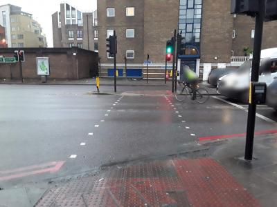 |
| Browse map: | Browse map |
# Level Crossing - crs_level
| Fieldname: | crs_level |
| Title: | Level Crossing |
| Description: | True = Crossing or rail/tram tracks on cycle lane/track False = Not a level crossing |
| Data type: | ENUM('TRUE','FALSE') |
| combineOptionalField: | |
| Example ID: | RWG123547 |
| Clarifications: | - |
| Convert geometry: | - |
| OSM tag(s): | TRUE: railway=crossing |
| OSM comment: | - |
| Action note: | - |
| query: | - |
| OSM Wiki page: | Tag:railway:level_crossing |
| Documentation: | TfL documentation for crs_level |
| Example image: | 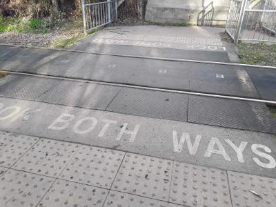 |
| Browse map: | Browse map |
# Segregated Cycles and Pedestrians - crs_segreg
| Fieldname: | crs_segreg |
| Title: | Segregated Cycles and Pedestrians |
| Description: | True = Cyclists segregated False = Shared with other users (e.g. pedestrians or horses) |
| Data type: | ENUM('TRUE','FALSE') |
| combineOptionalField: | |
| Example ID: | RWG065968 |
| Clarifications: | - |
| Convert geometry: | - |
| OSM tag(s): | TRUE: segregated=yes FALSE: segregated=no |
| OSM comment: | - |
| Action note: | - |
| query: | RWG065968 has no pedestrian crossing shown - does segregated imply no pedestrians; see issue #8 for discussion: https://github.com/cyclestreets/tflcid-conversion/issues/8 |
| OSM Wiki page: | Key:crossing |
| Documentation: | TfL documentation for crs_segreg |
| Example image: | 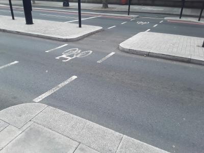 |
| Browse map: | Browse map |
# Cycle Gap - crs_cygap
| Fieldname: | crs_cygap |
| Title: | Cycle Gap |
| Description: | True = Crossing includes gap in island or kerb allowing cyclists only (NOT a refuge) False = Crossing does not include gap in island or kerb |
| Data type: | ENUM('TRUE','FALSE') |
| combineOptionalField: | |
| Example ID: | RWG065968 |
| Clarifications: | - |
| Convert geometry: | - |
| OSM tag(s): | - |
| OSM comment: | OSM has no real equivalent as OSM deals with linear flows rather than spaces |
| Action note: | Discard |
| query: | - |
| OSM Wiki page: | - |
| Documentation: | TfL documentation for crs_cygap |
| Example image: |  |
| Browse map: | Browse map |
# Cycle Lane/Track fields
| Name: | Cycle Lane/Track |
| Geometry type: | LineString |
| Description: | Formally designated road space for cyclists, usually identified with a combination of signs and line markings, and very often marked with the cycle symbol. Cycle lanes are parts of the road marked for use by cyclists. A bus lane that cyclists may use is regarded as a type of cycle lane. Cycle tracks are always off-carriageway, either next to it (associated with the footway) or completely away from the highway (e.g. canal towpaths, routes through parks). The ways that they are signed are more variable than cycle lanes. |
| Browse map: | Browse map |
| Fields: |
|
# Advisory Cycle Lane - clt_advis
| Fieldname: | clt_advis |
| Title: | Advisory Cycle Lane |
| Description: | True = Advisory lane False = Not an advisory lane |
| Data type: | ENUM('TRUE','FALSE') |
| combineOptionalField: | |
| Example ID: | RWG082115 |
| Clarifications: | - |
| Convert geometry: | - |
| OSM tag(s): | TRUE: cycleway:lane=advisory |
| OSM comment: | OSM has no differentiation between mandatory and advisory lane. Needs to be an official tag. |
| Action note: | Community needs to resolve this problem - has long been an issue in OSM. Suggested new tag. |
| query: | - |
| OSM Wiki page: | Tag:cycleway:lane |
| Documentation: | TfL documentation for clt_advis |
| Example image: | 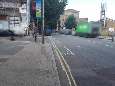 |
| Browse map: | Browse map |
# Cycle Bypass - clt_cbypas
| Fieldname: | clt_cbypas |
| Title: | Cycle Bypass |
| Description: | True = Bypass allowing turn without stopping at traffic signals False = Not a cycle bypass |
| Data type: | ENUM('TRUE','FALSE') |
| combineOptionalField: | |
| Example ID: | RWG056382 |
| Clarifications: | - |
| Convert geometry: | - |
| OSM tag(s): | TRUE: highway=cycleway, cycleway=track |
| OSM comment: | Simply draw geometry around the signals so that the Way is not subject to a signals Node |
| Action note: | - |
| query: | - |
| OSM Wiki page: | Tag:highway:traffic_signals#Tag_all_incoming_ways |
| Documentation: | TfL documentation for clt_cbypas |
| Example image: | 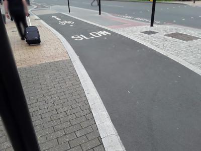 |
| Browse map: | Browse map |
# Mandatory Cycle Lane - clt_mandat
| Fieldname: | clt_mandat |
| Title: | Mandatory Cycle Lane |
| Description: | True = Mandatory lane False = Not a mandatory lane |
| Data type: | ENUM('TRUE','FALSE') |
| combineOptionalField: | |
| Example ID: | RWG082102 |
| Clarifications: | - |
| Convert geometry: | - |
| OSM tag(s): | TRUE: cycleway:lane=mandatory |
| OSM comment: | OSM has no differentiation between mandatory and advisory lane. Needs to be an official tag. |
| Action note: | Community needs to resolve this problem - has long been an issue in OSM. Suggested new tag. |
| query: | - |
| OSM Wiki page: | Tag:cycleway:lane |
| Documentation: | TfL documentation for clt_mandat |
| Example image: | 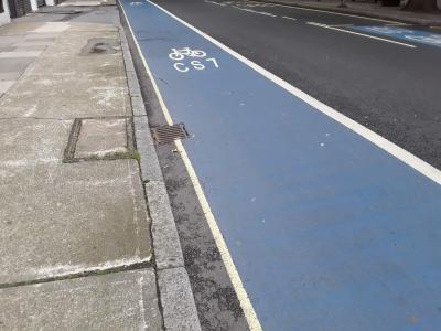 |
| Browse map: | Browse map |
# Partially Segregated Lane/Track - clt_parseg
| Fieldname: | clt_parseg |
| Title: | Partially Segregated Lane/Track |
| Description: | True = Partially or light segregated lane/track False = Not a partially or light segregated lane/track |
| Data type: | ENUM('TRUE','FALSE') |
| combineOptionalField: | |
| Example ID: | RWG135102 |
| Clarifications: | Spec needs careful reading to understand this - means different things when off-road vs on-road: https://www.cyclestreets.net/data/infrastructure/documentation/tflcid/clt_type.pdf |
| Convert geometry: | - |
| OSM tag(s): | IF clt_carr=TRUE then: treat as clt_steppp, i.e. TRUE: cycleway=track. Cycleway:track=hybrid ELSE clt_carr=FALSE treat as shared-use pavement but with light segregation: highway=cycleway, foot=yes, segregated=yes |
| OSM comment: | - |
| Action note: | - |
| query: | - |
| OSM Wiki page: | Key:cycleway |
| Documentation: | TfL documentation for clt_parseg |
| Example image: | 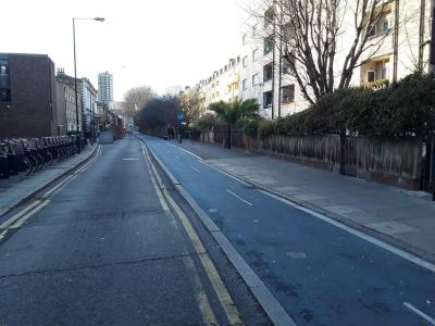 |
| Browse map: | Browse map |
# Segregated Lane/Track - clt_segreg
| Fieldname: | clt_segreg |
| Title: | Segregated Lane/Track |
| Description: | True = Fully segregated lane (i.e. On carriageway) / track (i.e. Off carriageway) False = Not fully segregated |
| Data type: | ENUM('TRUE','FALSE') |
| combineOptionalField: | |
| Example ID: | RWG066951 |
| Clarifications: | Segregated and shared are mutually-exclusive options, except for 6 unusual cases which should probably be handled as a special-case. |
| Convert geometry: | - |
| OSM tag(s): | TRUE: segregated=yes FALSE: segregated=no |
| OSM comment: | - |
| Action note: | - |
| query: | - |
| OSM Wiki page: | Key:segregated |
| Documentation: | TfL documentation for clt_segreg |
| Example image: | 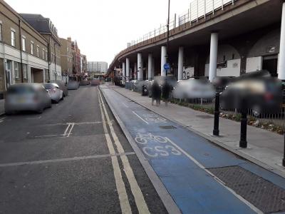 |
| Browse map: | Browse map |
# Shared Lane or Footway - clt_shared
| Fieldname: | clt_shared |
| Title: | Shared Lane or Footway |
| Description: | True = Shared lane (eg bus lane) True = Shared footway or track |
| Data type: | ENUM('TRUE','FALSE') |
| combineOptionalField: | |
| Example ID: | RWG073415 |
| Clarifications: | Spec needs careful reading to understand this - means different things when off-road vs on-road: https://www.cyclestreets.net/data/infrastructure/documentation/tflcid/clt_type.pdf |
| Convert geometry: | - |
| OSM tag(s): | IF clt_carr=TRUE then: TRUE: cycleway=share_busway ELSE clt_carr=FALSE treat as shared-use pavement: highway=cycleway, foot=yes, segregated=no |
| OSM comment: | - |
| Action note: | - |
| query: | - |
| OSM Wiki page: | Key:cycleway |
| Documentation: | TfL documentation for clt_shared |
| Example image: | 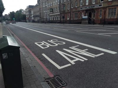 |
| Browse map: | Browse map |
# Stepped Lane/Track - clt_stepp
| Fieldname: | clt_stepp |
| Title: | Stepped Lane/Track |
| Description: | True = Stepped lane/track False = Not a stepped lane/track |
| Data type: | ENUM('TRUE','FALSE') |
| combineOptionalField: | |
| Example ID: | RWG108314 |
| Clarifications: | Also known as 'hybrid' cycle lane/track, as often found in Copenhagen, etc. |
| Convert geometry: | - |
| OSM tag(s): | TRUE: cycleway=track; cycleway:track=hybrid |
| OSM comment: | Essentially this is cycleway=track but should be tagged as part of the road probably. |
| Action note: | Community needs to resolve this problem - has long been an issue in OSM. Suggested new tag. Will need to resolve whether to treat as part of the road or separate geometry. |
| query: | - |
| OSM Wiki page: | Key:cycleway |
| Documentation: | TfL documentation for clt_stepp |
| Example image: | 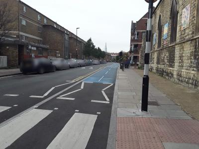 |
| Browse map: | Browse map |
# On-Carriageway (if true) or Off-Carriageway (if false) - clt_carr
| Fieldname: | clt_carr |
| Title: | On-Carriageway (if true) or Off-Carriageway (if false) |
| Description: | True = On carriageway False = Off carriageway |
| Data type: | ENUM('TRUE','FALSE') |
| combineOptionalField: | |
| Example ID: | RWG066384 |
| Clarifications: | The specific extent of each section of cycle lane (which in London can be rather start-top) is very detailed - far better than OSM's. |
| Convert geometry: | - |
| OSM tag(s): | TRUE: cycleway:left=lane or cycleway:right=lane FALSE: cycleway=track |
| OSM comment: | If lane, attach to existing highway |
| Action note: | - |
| query: | - |
| OSM Wiki page: | Tag:cycleway:lane |
| Documentation: | TfL documentation for clt_carr |
| Example image: | 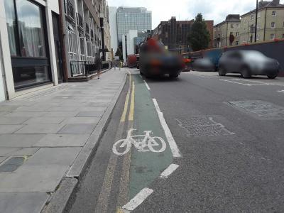 |
| Browse map: | Browse map |
# Bi-directional - clt_bidire
| Fieldname: | clt_bidire |
| Title: | Bi-directional |
| Description: | True = Two way flow on lane/track/path False = Single direction lane/track/path |
| Data type: | ENUM('TRUE','FALSE') |
| combineOptionalField: | |
| Example ID: | RWG056370 |
| Clarifications: | - |
| Convert geometry: | - |
| OSM tag(s): | TRUE: oneway:bicycle=no |
| OSM comment: | If geometry is dedicated cycleway, use simple oneway=no rather than oneway:bicycle=no |
| Action note: | - |
| query: | - |
| OSM Wiki page: | Key:oneway |
| Documentation: | TfL documentation for clt_bidire |
| Example image: | 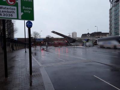 |
| Browse map: | Browse map |
# Continuous Cycle Facilities at Bus Stop - clt_bbypas
| Fieldname: | clt_bbypas |
| Title: | Continuous Cycle Facilities at Bus Stop |
| Description: | True = Cycle track carries on through the bus stop area False = Not a continuous cycle facility |
| Data type: | ENUM('TRUE','FALSE') |
| combineOptionalField: | |
| Example ID: | RWG152754 |
| Clarifications: | Known as a bus-stop bypass |
| Convert geometry: | - |
| OSM tag(s): | TRUE: highway=cycleway, cycleway=track |
| OSM comment: | Simply draw geometry around the signals so that the Way is not subject to a signals Node |
| Action note: | - |
| query: | - |
| OSM Wiki page: | Tag:cycleway=track |
| Documentation: | TfL documentation for clt_bbypas |
| Example image: | 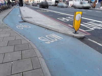 |
| Browse map: | Browse map |
# Colour - clt_colour
| Fieldname: | clt_colour |
| Title: | Colour |
| Description: | Colour of lane/track - Limited to only the following entries: None, Green, Red, Blue, Buff/Yellow, Other |
| Data type: | ENUM('NONE','GREEN','RED','BLUE','BUFF/YELLOW','OTHER') |
| combineOptionalField: | |
| Example ID: | RWG108351 |
| Clarifications: | - |
| Convert geometry: | - |
| OSM tag(s): | GREEN: surface:colour=green RED surface:colour=red BLUE: surface:colour=blue BUFF/YELLOW: surface:colour=yellow |
| OSM comment: | Taginfo suggests that surface:colour is least uncommon way to represent this, e.g. red is 4,388 cases worldwide: https://taginfo.openstreetmap.org/keys/surface:colour#values |
| Action note: | - |
| query: | - |
| OSM Wiki page: | Key:colour |
| Documentation: | |
| Example image: | 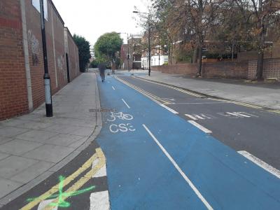 |
| Browse map: | Browse map |
# Contraflow Lane/Track - clt_contra
| Fieldname: | clt_contra |
| Title: | Contraflow Lane/Track |
| Description: | True = Contraflow lane/track (NOT if bi-directional) False = With flow |
| Data type: | ENUM('TRUE','FALSE') |
| combineOptionalField: | |
| Example ID: | RWG082682 |
| Clarifications: | - |
| Convert geometry: | - |
| OSM tag(s): | TRUE: If clt_mandat=TRUE THEN cycleway=opposite_lane, oneway=yes ELSE cycleway=opposite, oneway=yes |
| OSM comment: | Directionality will need to be established |
| Action note: | - |
| query: | clt_contra=TRUE should presuably have clt_advis=TRUE in cases like RWG082002? |
| OSM Wiki page: | Tag:cycleway:opposite_lane |
| Documentation: | TfL documentation for clt_contra |
| Example image: | 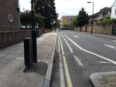 |
| Browse map: | Browse map |
# Cycle Lane/Track Priority - clt_priori
| Fieldname: | clt_priori |
| Title: | Cycle Lane/Track Priority |
| Description: | True = Cycles have priority, other traffic has to give way False = Cycles do not have priority |
| Data type: | ENUM('TRUE','FALSE') |
| combineOptionalField: | |
| Example ID: | RWG082352 |
| Clarifications: | This basically refers to retaining continuity at sideroads |
| Convert geometry: | - |
| OSM tag(s): | TRUE: cycleway:sideroad_continuity=yes |
| OSM comment: | OSM has no means to represent this, and simply drawing a continuous lane past the sideroad is unlikely to be enough, as many give-way cycle lanes are represented that way. |
| Action note: | Community needs to resolve this problem - has long been an issue in OSM. Suggested new tag. |
| query: | - |
| OSM Wiki page: | Tag:cycleway:lane |
| Documentation: | TfL documentation for clt_priori |
| Example image: | 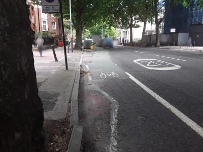 |
| Browse map: | Browse map |
# Park Route - clt_parkr
| Fieldname: | clt_parkr |
| Title: | Park Route |
| Description: | True = Road/lane/track through park False = Not a park route |
| Data type: | ENUM('TRUE','FALSE') |
| combineOptionalField: | |
| Example ID: | RWG109047 |
| Clarifications: | - |
| Convert geometry: | - |
| OSM tag(s): | TRUE: bicycle=yes IF geometry not already present, also add highway=cycleway |
| OSM comment: | Maintain existing highway type (i.e. footway vs cycleway) |
| Action note: | - |
| query: | - |
| OSM Wiki page: | Bicycle#Bicycle_Restrictions |
| Documentation: | |
| Example image: | 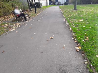 |
| Browse map: | Browse map |
# Waterside Route - clt_waterr
| Fieldname: | clt_waterr |
| Title: | Waterside Route |
| Description: | True = Route beside river, canal or other watercourse False = Not a waterside route |
| Data type: | ENUM('TRUE','FALSE') |
| combineOptionalField: | |
| Example ID: | RWG151034 |
| Clarifications: | - |
| Convert geometry: | - |
| OSM tag(s): | - |
| OSM comment: | No special tagging needed to represent it being riparian |
| Action note: | - |
| query: | - |
| OSM Wiki page: | Bicycle |
| Documentation: | |
| Example image: | 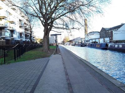 |
| Browse map: | Browse map |
# Part-time (if true) or Full-time (if false) - clt_ptime
| Fieldname: | clt_ptime |
| Title: | Part-time (if true) or Full-time (if false) |
| Description: | True = Part-time
False = Full-time |
| Data type: | ENUM('TRUE','FALSE') |
| combineOptionalField: | |
| Example ID: | RWG030537 |
| Clarifications: | - |
| Convert geometry: | - |
| OSM tag(s): | - |
| OSM comment: | No special tagging needed beyond putting opening hours (see below) |
| Action note: | - |
| query: | - |
| OSM Wiki page: | Key:opening_hours |
| Documentation: | TfL documentation for clt_ptime |
| Example image: | 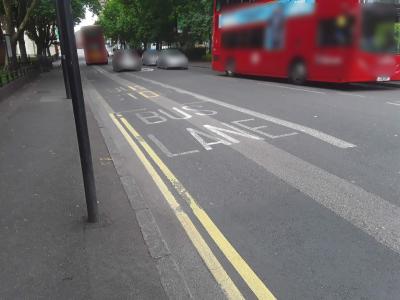 |
| Browse map: | Browse map |
# Access Times - clt_access
| Fieldname: | clt_access |
| Title: | Access Times |
| Description: | Times route is accessible (either exact times or description) |
| Data type: | VARCHAR(255) |
| combineOptionalField: | |
| Example ID: | RWG030537 |
| Clarifications: | - |
| Convert geometry: | - |
| OSM tag(s): | TRUE: opening_hours= |
| OSM comment: | Time will need to be converted, e.g. case insensitive conversion of "Mon to Sun 7am to 7PM" to "Mo-Su 07:00-19:00"; free-text descriptions will need further parsing. |
| Action note: | - |
| query: | - |
| OSM Wiki page: | Key:opening_hours |
| Documentation: | TfL documentation for clt_access |
| Example image: |  |
| Browse map: | Browse map |
# Cycle Parking fields
| Name: | Cycle Parking |
| Geometry type: | Point |
| Description: | Cycle parking assets such as cycle stands or racks to which cycles can be locked. In some locations cycle parking consists of lockers or a secure compound. |
| Browse map: | Browse map |
| Fields: |
|
# Sheffield Stand - prk_sheff
| Fieldname: | prk_sheff |
| Title: | Sheffield Stand |
| Description: | True = Sheffield stand (including TfL type) or variant False = Not a sheffield stand |
| Data type: | ENUM('TRUE','FALSE') |
| combineOptionalField: | |
| Example ID: | RWG058176 |
| Clarifications: | - |
| Convert geometry: | - |
| OSM tag(s): | TRUE: bicycle_parking=stands |
| OSM comment: | - |
| Action note: | - |
| query: | - |
| OSM Wiki page: | Key:bicycle_parking |
| Documentation: | TfL documentation for prk_sheff |
| Example image: | 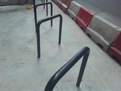 |
| Browse map: | Browse map |
# "M" stand - prk_mstand
| Fieldname: | prk_mstand |
| Title: | "M" stand |
| Description: | True = "M" stand (variety of stand that resembles a letter M) False = Not an "M" stand |
| Data type: | ENUM('TRUE','FALSE') |
| combineOptionalField: | |
| Example ID: | RWG058079 |
| Clarifications: | - |
| Convert geometry: | - |
| OSM tag(s): | TRUE: bicycle_parking=stands |
| OSM comment: | OSM has no differentiation between different variants of sheffield-style stands. Introduction of such a variation is unlikely to be entertained, as downstream users of the data would not consider the difference important. |
| Action note: | Worth checking that the community isn't likely to want to add this level of detail beyond bicycle_parking=stands |
| query: | - |
| OSM Wiki page: | Key:bicycle_parking |
| Documentation: | TfL documentation for prk_mstand |
| Example image: | 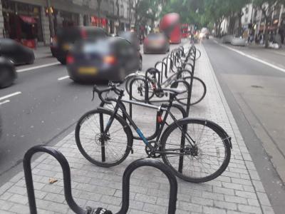 |
| Browse map: | Browse map |
# "P" stand - prk_pstand
| Fieldname: | prk_pstand |
| Title: | "P" stand |
| Description: | True = P, flag or pennant stand (variety of stand that resembles a letter P) False = Not a "P" stand |
| Data type: | ENUM('TRUE','FALSE') |
| combineOptionalField: | |
| Example ID: | RWG058127 |
| Clarifications: | - |
| Convert geometry: | - |
| OSM tag(s): | TRUE: bicycle_parking=stands |
| OSM comment: | OSM has no differentiation between different variants of sheffield-style stands. Introduction of such a variation is unlikely to be entertained, as downstream users of the data would not consider the difference important. |
| Action note: | Worth checking that the community isn't likely to want to add this level of detail beyond bicycle_parking=stands |
| query: | - |
| OSM Wiki page: | Key:bicycle_parking |
| Documentation: | TfL documentation for prk_pstand |
| Example image: | 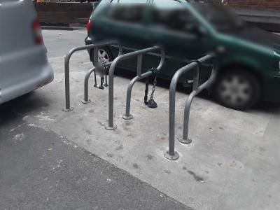 |
| Browse map: | Browse map |
# Bike Hangar - prk_hangar
| Fieldname: | prk_hangar |
| Title: | Bike Hangar |
| Description: | True = Bike hangar False = Not a bike hangar |
| Data type: | ENUM('TRUE','FALSE') |
| combineOptionalField: | |
| Example ID: | RWG056741 |
| Clarifications: | - |
| Convert geometry: | - |
| OSM tag(s): | TRUE: bicycle_parking=lockers |
| OSM comment: | OSM community would probably reject bicycle_parking=bike_hanger as too similar to lockers |
| Action note: | - |
| query: | - |
| OSM Wiki page: | Key:bicycle_parking |
| Documentation: | TfL documentation for prk_hangar |
| Example image: | 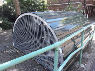 |
| Browse map: | Browse map |
# Cyclehoop - prk_hoop
| Fieldname: | prk_hoop |
| Title: | Cyclehoop |
| Description: | True = Cyclehoop False = Not a cyclehoop |
| Data type: | ENUM('TRUE','FALSE') |
| combineOptionalField: | |
| Example ID: | RWG058678 |
| Clarifications: | - |
| Convert geometry: | - |
| OSM tag(s): | TRUE: bicycle_parking=cyclehoop |
| OSM comment: | No such tag currently (though bicycle_parking=bollard is near), but volume of these makes this worth going through standardisation process and using |
| Action note: | Community consultation needed for proposed new tag |
| query: | - |
| OSM Wiki page: | Key:bicycle_parking |
| Documentation: | TfL documentation for prk_hoop |
| Example image: | 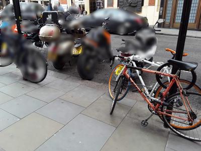 |
| Browse map: | Browse map |
# Locker - prk_locker
| Fieldname: | prk_locker |
| Title: | Locker |
| Description: | True = Locker using own or integral lock False = No locker present |
| Data type: | ENUM('TRUE','FALSE') |
| combineOptionalField: | |
| Example ID: | RWG108498 |
| Clarifications: | - |
| Convert geometry: | - |
| OSM tag(s): | TRUE: bicycle_parking=lockers note=Locker using own or integral lock |
| OSM comment: | No current tag for own lock - probably best to add note rather than try to invent new tag as small volume of data |
| Action note: | - |
| query: | - |
| OSM Wiki page: | Key:bicycle_parking |
| Documentation: | TfL documentation for prk_locker |
| Example image: | 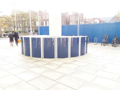 |
| Browse map: | Browse map |
# Secure - prk_secure
| Fieldname: | prk_secure |
| Title: | Secure |
| Description: | True = Locked compound with shared or combination lock provided by operator False = Not a locked compound |
| Data type: | ENUM('TRUE','FALSE') |
| combineOptionalField: | |
| Example ID: | RWG057756 |
| Clarifications: | - |
| Convert geometry: | - |
| OSM tag(s): | TRUE: bicycle_parking=locker note=Locked compound with shared or combination lock provided by operator |
| OSM comment: | No current tag for own lock - probably best to add note rather than try to invent new tag as small volume of data |
| Action note: | - |
| query: | - |
| OSM Wiki page: | Key:bicycle_parking |
| Documentation: | TfL documentation for prk_secure |
| Example image: | 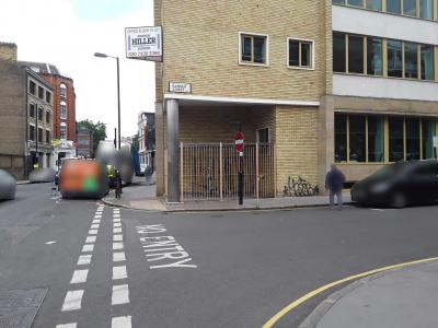 |
| Browse map: | Browse map |
# Two Tier - prk_tier
| Fieldname: | prk_tier |
| Title: | Two Tier |
| Description: | True = Multi tiered cycle parking False = Not a multi tiered cycle parking |
| Data type: | ENUM('TRUE','FALSE') |
| combineOptionalField: | |
| Example ID: | RWG058283 |
| Clarifications: | - |
| Convert geometry: | - |
| OSM tag(s): | TRUE: bicycle_parking=two_tier |
| OSM comment: | 6 instances worldwide in use, but needs standardisation |
| Action note: | Community consultation needed for proposed new tag |
| query: | - |
| OSM Wiki page: | Key:bicycle_parking |
| Documentation: | TfL documentation for prk_tier |
| Example image: | 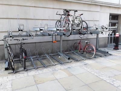 |
| Browse map: | Browse map |
# Butterfly - prk_buterf
| Fieldname: | prk_buterf |
| Title: | Butterfly |
| Description: | True = Butterfly/wheelbender False = Not a butterfly/wheelbender |
| Data type: | ENUM('TRUE','FALSE') |
| combineOptionalField: | |
| Example ID: | RWG057241 |
| Clarifications: | - |
| Convert geometry: | - |
| OSM tag(s): | TRUE: bicycle_parking=wall_loops |
| OSM comment: | - |
| Action note: | - |
| query: | - |
| OSM Wiki page: | Key:bicycle_parking |
| Documentation: | TfL documentation for prk_buterf |
| Example image: | 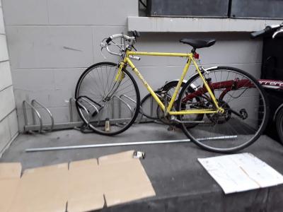 |
| Browse map: | Browse map |
# Post - prk_post
| Fieldname: | prk_post |
| Title: | Post |
| Description: | True = Post False = Not a post |
| Data type: | ENUM('TRUE','FALSE') |
| combineOptionalField: | |
| Example ID: | RWG057325 |
| Clarifications: | - |
| Convert geometry: | - |
| OSM tag(s): | TRUE: bicycle_parking=bollard |
| OSM comment: | Not 100% the same, but near enough with the same intent |
| Action note: | - |
| query: | - |
| OSM Wiki page: | Key:bicycle_parking |
| Documentation: | TfL documentation for prk_post |
| Example image: | 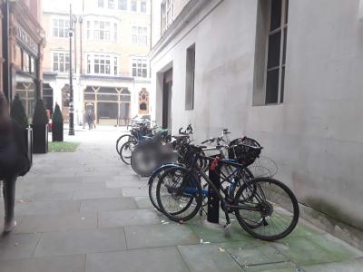 |
| Browse map: | Browse map |
# Wheel Rack - prk_wheel
| Fieldname: | prk_wheel |
| Title: | Wheel Rack |
| Description: | True = Wheel rack or slot False = Not a wheel rack or slot |
| Data type: | ENUM('TRUE','FALSE') |
| combineOptionalField: | |
| Example ID: | RWG058788 |
| Clarifications: | - |
| Convert geometry: | - |
| OSM tag(s): | TRUE: bicycle_parking=upright_stands |
| OSM comment: | No such tag currently, but are reasonably common around the UK, so worth going through standardisation |
| Action note: | Community consultation needed for proposed new tag |
| query: | - |
| OSM Wiki page: | Key:bicycle_parking |
| Documentation: | TfL documentation for prk_wheel |
| Example image: | 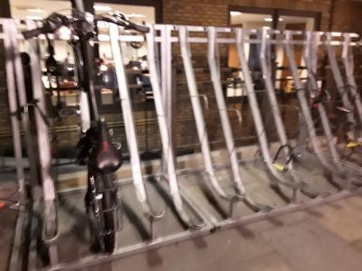 |
| Browse map: | Browse map |
# Other - prk_other
| Fieldname: | prk_other |
| Title: | Other |
| Description: | True = Other or unknown type of cycle parking False = Not an unknown type of cycle parking |
| Data type: | ENUM('TRUE','FALSE') |
| combineOptionalField: | |
| Example ID: | RWG058076 |
| Clarifications: | Various types |
| Convert geometry: | - |
| OSM tag(s): | TRUE: amenity=bicycle_parking bicycle_parking= |
| OSM comment: | - |
| Action note: | Done on case-by-case basis; will need manual review |
| query: | - |
| OSM Wiki page: | Key:bicycle_parking |
| Documentation: | TfL documentation for prk_other |
| Example image: | 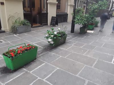 |
| Browse map: | Browse map |
# Carriageway - prk_carr
| Fieldname: | prk_carr |
| Title: | Carriageway |
| Description: | True = On carriageway False = Off carriageway |
| Data type: | ENUM('TRUE','FALSE') |
| combineOptionalField: | |
| Example ID: | RWG056990 |
| Clarifications: | - |
| Convert geometry: | - |
| OSM tag(s): | TRUE: carriageway=yes |
| OSM comment: | OSM has no tagging support for this at present, but this would be useful |
| Action note: | Community consultation needed for proposed new tag |
| query: | Please send through a photo as no examples yet |
| OSM Wiki page: | Tag:amenity:bicycle_parking |
| Documentation: | TfL documentation for prk_carr |
| Example image: | 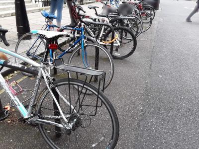 |
| Browse map: | Browse map |
# Provision - prk_provis
| Fieldname: | prk_provis |
| Title: | Provision |
| Description: | Number of stands or discrete units |
| Data type: | INT(11) |
| combineOptionalField: | |
| Example ID: | RWG058807 |
| Clarifications: | - |
| Convert geometry: | - |
| OSM tag(s): | - |
| OSM comment: | - |
| Action note: | Ignore, as capacity is value relevant to OSM (see next) |
| query: | - |
| OSM Wiki page: | Tag:amenity:bicycle_parking |
| Documentation: | TfL documentation for prk_provis |
| Example image: | 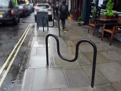 |
| Browse map: | Browse map |
# Capacity - prk_cpt
| Fieldname: | prk_cpt |
| Title: | Capacity |
| Description: | Number of bikes that can be parked without difficulty |
| Data type: | INT(11) |
| combineOptionalField: | |
| Example ID: | RWG058807 |
| Clarifications: | - |
| Convert geometry: | - |
| OSM tag(s): | capacity= |
| OSM comment: | - |
| Action note: | - |
| query: | - |
| OSM Wiki page: | Tag:amenity:bicycle_parking |
| Documentation: | TfL documentation for prk_cpt |
| Example image: |  |
| Browse map: | Browse map |
# Covered - prk_cover
| Fieldname: | prk_cover |
| Title: | Covered |
| Description: | True = Covered or sheltered (including partial shelter) False = No cover |
| Data type: | ENUM('TRUE','FALSE') |
| combineOptionalField: | |
| Example ID: | RWG057023 |
| Clarifications: | - |
| Convert geometry: | - |
| OSM tag(s): | TRUE: covered=yes |
| OSM comment: | - |
| Action note: | - |
| query: | - |
| OSM Wiki page: | Tag:amenity:bicycle_parking |
| Documentation: | TfL documentation for prk_cover |
| Example image: | 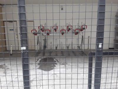 |
| Browse map: | Browse map |
# Restricted Point fields
| Name: | Restricted Point |
| Geometry type: | Point |
| Description: | Restricting elements such as steps or lifts. |
| Browse map: | Browse map |
| Fields: |
# Steps - rst_steps
| Fieldname: | rst_steps |
| Title: | Steps |
| Description: | True = This feature is only relevant where steps link routes where cycling is permitted. False = No steps |
| Data type: | ENUM('TRUE','FALSE') |
| combineOptionalField: | |
| Example ID: | RWG025668 |
| Clarifications: | - |
| Convert geometry: | node->way |
| OSM tag(s): | TRUE: highway=steps |
| OSM comment: | Incline=up/down is recommended but doesn't seem to be heavily-used these days, and can be implied by the router anyway; in cycling terms the directionality is not very important, as it is full dismount operation anyway. |
| Action note: | - |
| query: | - |
| OSM Wiki page: | Tag:highway:steps |
| Documentation: | TfL documentation for rst_steps |
| Example image: | 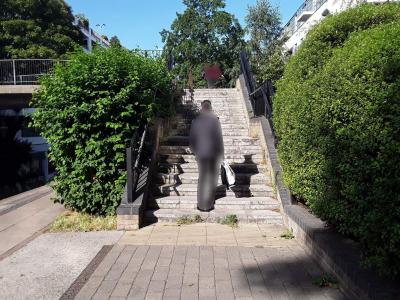 |
| Browse map: | Browse map |
# Lift - rst_lift
| Fieldname: | rst_lift |
| Title: | Lift |
| Description: | True = This feature is only relevant where a lift links routes where cycling is permitted. False = No lift |
| Data type: | ENUM('TRUE','FALSE') |
| combineOptionalField: | |
| Example ID: | RWG151744 |
| Clarifications: | - |
| Convert geometry: | - |
| OSM tag(s): | TRUE: highway=elevator, bicycle=yes |
| OSM comment: | - |
| Action note: | - |
| query: | - |
| OSM Wiki page: | Tag:highway:elevator |
| Documentation: | TfL documentation for rst_lift |
| Example image: |  |
| Browse map: | Browse map |
# Restricted Route fields
| Name: | Restricted Route |
| Geometry type: | LineString |
| Description: | Short linking routes, on links that form part of signed or otherwise designated cycle routes, that cyclists may use if they dismount. |
| Browse map: | Browse map |
| Fields: |
# Pedestrian-Only Route - res_pedest
| Fieldname: | res_pedest |
| Title: | Pedestrian-Only Route |
| Description: | True = Pedestrian-only route linking cycle routes False = Not a pedestrian-only route |
| Data type: | ENUM('TRUE','FALSE') |
| combineOptionalField: | |
| Example ID: | RWG097769 |
| Clarifications: | - |
| Convert geometry: | - |
| OSM tag(s): | TRUE: highway=footway, bicycle=dismount |
| OSM comment: | - |
| Action note: | - |
| query: | - |
| OSM Wiki page: | Tag:highway:footway |
| Documentation: | TfL documentation for res_pedest |
| Example image: | 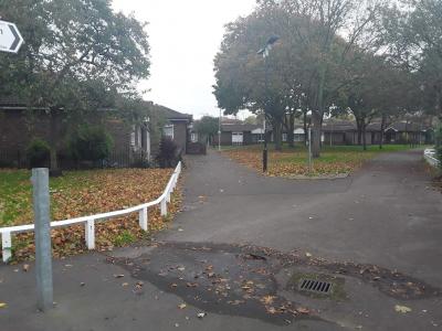 |
| Browse map: | Browse map |
# Steps - res_steps
| Fieldname: | res_steps |
| Title: | Steps |
| Description: | True = Route includes steps to/from a particular cycle route which form part of a linear link route False = No steps |
| Data type: | ENUM('TRUE','FALSE') |
| combineOptionalField: | |
| Example ID: | RWG152371 |
| Clarifications: | - |
| Convert geometry: | - |
| OSM tag(s): | TRUE: highway=steps |
| OSM comment: | Incline=up/down is recommended but doesn't seem to be heavily-used these days, and can be implied by the router anyway; in cycling terms the directionality is not very important, as it is full dismount operation anyway. |
| Action note: | - |
| query: | - |
| OSM Wiki page: | Tag:highway:steps |
| Documentation: | TfL documentation for res_steps |
| Example image: | 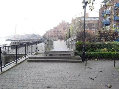 |
| Browse map: | Browse map |
# Lift - res_lift
| Fieldname: | res_lift |
| Title: | Lift |
| Description: | True = Route includes lift to/from a particular cycle route which forms part of a linear link route False = No lift |
| Data type: | ENUM('TRUE','FALSE') |
| combineOptionalField: | |
| Example ID: | RWG109094 |
| Clarifications: | - |
| Convert geometry: | - |
| OSM tag(s): | TRUE: highway=elevator, bicycle=yes |
| OSM comment: | - |
| Action note: | - |
| query: | - |
| OSM Wiki page: | Tag:highway:elevator |
| Documentation: | TfL documentation for res_lift |
| Example image: | 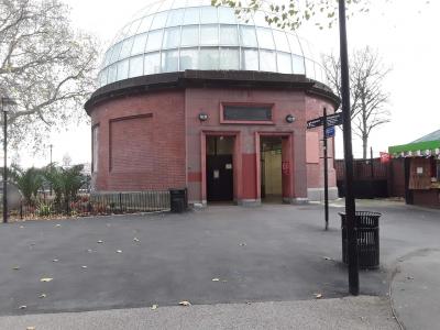 |
| Browse map: | Browse map |
# Pedestrian Bridge - res_bridge
| Fieldname: | res_bridge |
| Title: | Pedestrian Bridge |
| Description: | True = Route includes a pedestrian bridge False = Route does not include a pedestrian bridge |
| Data type: | ENUM('TRUE','FALSE') |
| combineOptionalField: | |
| Example ID: | RWG276596 |
| Clarifications: | - |
| Convert geometry: | - |
| OSM tag(s): | TRUE: highway=footway, bridge=yes, layer=1, bicycle=dismount |
| OSM comment: | The value for layer potentially would need checking in case passing over more complex area. |
| Action note: | - |
| query: | - |
| OSM Wiki page: | Key:bridge |
| Documentation: | TfL documentation for res_bridge |
| Example image: | 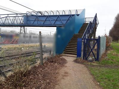 |
| Browse map: | Browse map |
# Pedestrian Tunnel - res_tunnel
| Fieldname: | res_tunnel |
| Title: | Pedestrian Tunnel |
| Description: | True = Route includes a pedestrian tunnel/subway False = Route does not include a pedestrian tunnel/subway |
| Data type: | ENUM('TRUE','FALSE') |
| combineOptionalField: | |
| Example ID: | RWG082656 |
| Clarifications: | - |
| Convert geometry: | - |
| OSM tag(s): | TRUE: highway=footway, tunnel=yes, layer=-1, bicycle=dismount |
| OSM comment: | - |
| Action note: | - |
| query: | - |
| OSM Wiki page: | Key:tunnel |
| Documentation: | TfL documentation for res_tunnel |
| Example image: | 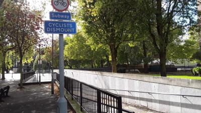 |
| Browse map: | Browse map |
# Signage fields
# Direction Arrow - ss_arrow
| Fieldname: | ss_arrow |
| Title: | Direction Arrow |
| Description: | True = Contraflow or one-way False = Not contraflow or one-way |
| Data type: | ENUM('TRUE','FALSE') |
| combineOptionalField: | |
| Example ID: | RWG075567 |
| Clarifications: | Represents path present as lane data anyway, e.g. RWG075567 is sign for lane RWG135732. |
| Convert geometry: | - |
| OSM tag(s): | - |
| OSM comment: | Not useful. |
| Action note: | Discard |
| query: | - |
| OSM Wiki page: | - |
| Documentation: | TfL documentation for ss_arrow |
| Example image: | 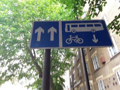 |
| Browse map: | Browse map |
# Bus Symbol - ss_bussmb
| Fieldname: | ss_bussmb |
| Title: | Bus Symbol |
| Description: | True = Bus symbol False = Bus symbol not present |
| Data type: | ENUM('TRUE','FALSE') |
| combineOptionalField: | |
| Example ID: | RWG074937 |
| Clarifications: | May indicate bus lane, which will be present as lane data anyway, e.g. RWG074937 is sign for lane RWG082029. |
| Convert geometry: | - |
| OSM tag(s): | - |
| OSM comment: | Not useful. |
| Action note: | Discard |
| query: | - |
| OSM Wiki page: | - |
| Documentation: | TfL documentation for ss_bussmb |
| Example image: | 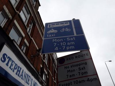 |
| Browse map: | Browse map |
# Cycle Symbol - ss_cycsmb
| Fieldname: | ss_cycsmb |
| Title: | Cycle Symbol |
| Description: | True = Cycle symbol or marker False = Cycle symbol or market not present |
| Data type: | ENUM('TRUE','FALSE') |
| combineOptionalField: | |
| Example ID: | RWG210835 |
| Clarifications: | May be physical sign or painted on road. Very general attribute. Best to make use of TRSGD number instead to disambiguate type. |
| Convert geometry: | - |
| OSM tag(s): | - |
| OSM comment: | Not useful. |
| Action note: | Discard |
| query: | - |
| OSM Wiki page: | - |
| Documentation: | TfL documentation for ss_cycsmb |
| Example image: | 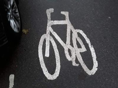 |
| Browse map: | Browse map |
# Cyclists Dismount - ss_dismou
| Fieldname: | ss_dismou |
| Title: | Cyclists Dismount |
| Description: | True = Cyclist dismount sign False = Not a dismount sign |
| Data type: | ENUM('TRUE','FALSE') |
| combineOptionalField: | |
| Example ID: | RWG081585 |
| Clarifications: | - |
| Convert geometry: | node->way |
| OSM tag(s): | TRUE: Where target road is visually inferred to be predominantly for pedestrians, set highway=footway, bicycle=yes |
| OSM comment: | Caution is required here in tagging. A Cyclists dismount sign in the UK, which is a recommendation that can be ignored (unlike a No cycling sign), does not mean the same thing as bicycle=dismount, which refers to cyclists being required to dismount and wa |
| Action note: | OSM community needs to have a proper way to represent the UK recommendation Cyclists dismount, but this is a massive can of worms. OSM wiki pages https://wiki.openstreetmap.org/wiki/Key:access#Access_tag_values and https://wiki.openstreetmap.org/wiki/Bicy |
| query: | Was this intended to include unofficial signage which has no legal basis, e.g. RWG107990 and probably RWG075952? |
| OSM Wiki page: | Key:access#Access_tag_values |
| Documentation: | TfL documentation for ss_dismou |
| Example image: | 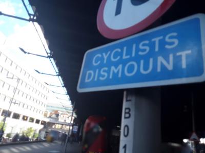 |
| Browse map: | Browse map |
# End of Route - ss_end
| Fieldname: | ss_end |
| Title: | End of Route |
| Description: | True = End of route sign False = Not an end of route sign |
| Data type: | ENUM('TRUE','FALSE') |
| combineOptionalField: | |
| Example ID: | RWG053432 |
| Clarifications: | May be physical sign or painted on road. |
| Convert geometry: | - |
| OSM tag(s): | - |
| OSM comment: | Not useful. |
| Action note: | Discard |
| query: | - |
| OSM Wiki page: | - |
| Documentation: | TfL documentation for ss_end |
| Example image: | 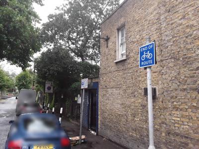 |
| Browse map: | Browse map |
# Greenway - ss_greenw
| Fieldname: | ss_greenw |
| Title: | Greenway |
| Description: | True = Greenway sign, symbol or marker False = Not a Greenway sign, symbol or marker |
| Data type: | ENUM('TRUE','FALSE') |
| combineOptionalField: | |
| Example ID: | RWG153642 |
| Clarifications: | Generally rather locally-specific routes, not many. |
| Convert geometry: | node->way/relation |
| OSM tag(s): | TRUE: Add relation, with route=bicycle, network=lcn |
| OSM comment: | Seem to be very localised, so network=lcn most appropriate |
| Action note: | - |
| query: | - |
| OSM Wiki page: | WikiProject_Europe/Greenways |
| Documentation: | TfL documentation for ss_greenw |
| Example image: | 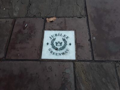 |
| Browse map: | Browse map |
# London Cycle Network - ss_lcn
| Fieldname: | ss_lcn |
| Title: | London Cycle Network |
| Description: | True = London Cycle Network sign or symbol False = Not a London Cycle Network sign or symbol |
| Data type: | ENUM('TRUE','FALSE') |
| combineOptionalField: | |
| Example ID: | RWG081669 |
| Clarifications: | - |
| Convert geometry: | node->way/relation |
| OSM tag(s): | TRUE: network=lcn |
| OSM comment: | Very likely indeed to be present already as is high-profile data. |
| Action note: | - |
| query: | - |
| OSM Wiki page: | - |
| Documentation: | TfL documentation for ss_lcn |
| Example image: | 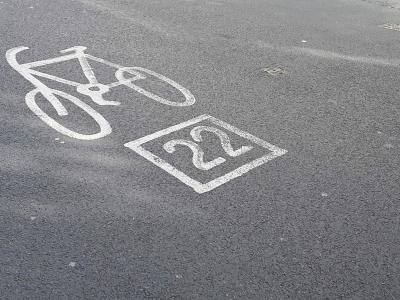 |
| Browse map: | Browse map |
# National Cycle Network - ss_ncn
| Fieldname: | ss_ncn |
| Title: | National Cycle Network |
| Description: | True = National Cycle Network sign, symbol or sticker False = Not a National Cycle Network sign, symbol or sticker |
| Data type: | ENUM('TRUE','FALSE') |
| combineOptionalField: | |
| Example ID: | RWG076510 |
| Clarifications: | - |
| Convert geometry: | node->way/relation |
| OSM tag(s): | TRUE: network=ncn |
| OSM comment: | Very likely indeed to be present already as is high-profile data. |
| Action note: | - |
| query: | - |
| OSM Wiki page: | - |
| Documentation: | TfL documentation for ss_ncn |
| Example image: | 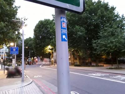 |
| Browse map: | Browse map |
# Pedestrian Symbol - ss_pedsmb
| Fieldname: | ss_pedsmb |
| Title: | Pedestrian Symbol |
| Description: | True = Pedestrian symbol False = Pedestrian symbol not present |
| Data type: | ENUM('TRUE','FALSE') |
| combineOptionalField: | |
| Example ID: | RWG210835 |
| Clarifications: | Best to make use of TRSGD number instead to disambiguate type. Accompanies lane which is more useful, e.g. RWG107871 represents lane RWG108055. |
| Convert geometry: | - |
| OSM tag(s): | - |
| OSM comment: | Not useful. |
| Action note: | Discard |
| query: | - |
| OSM Wiki page: | - |
| Documentation: | TfL documentation for ss_pedsmb |
| Example image: |  |
| Browse map: | Browse map |
# Quietway - ss_quietw
| Fieldname: | ss_quietw |
| Title: | Quietway |
| Description: | True = Quietway sign or symbol False = Not a Quietway sign or symbol |
| Data type: | ENUM('TRUE','FALSE') |
| combineOptionalField: | |
| Example ID: | RWG053720 |
| Clarifications: | Quietways not present as adjacent cycle lane/track data, so is useful |
| Convert geometry: | node->way/relation |
| OSM tag(s): | TRUE: network=rcn |
| OSM comment: | Quietways have good coverage already, so this is likely to be a low-priority implementation task. Maybe more useful to do visual verification that signage follows the Ways. |
| Action note: | Join up locations to create routable lines, then associate with nearby ways. |
| query: | - |
| OSM Wiki page: | London_Cycle_Network#Quietways |
| Documentation: | TfL documentation for ss_quietw |
| Example image: | 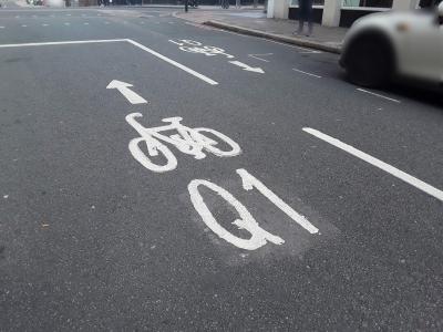 |
| Browse map: | Browse map |
# Other Vehicle Symbol - ss_smb
| Fieldname: | ss_smb |
| Title: | Other Vehicle Symbol |
| Description: | True = Taxi/Motorcycle/Horse symbol False = Taxi/Motorcycle/Horse symbol not present |
| Data type: | ENUM('TRUE','FALSE') |
| combineOptionalField: | |
| Example ID: | RWG075621 |
| Clarifications: | May be physical sign or painted on road. May indicate bus lane, which will be present as lane data anyway, e.g. RWG075621 is sign for lane RWG082675. |
| Convert geometry: | - |
| OSM tag(s): | - |
| OSM comment: | Not useful. |
| Action note: | Discard |
| query: | - |
| OSM Wiki page: | - |
| Documentation: | TfL documentation for ss_smb |
| Example image: | 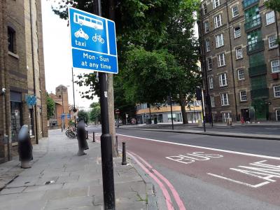 |
| Browse map: | Browse map |
# Cycle Superhighway - ss_superh
| Fieldname: | ss_superh |
| Title: | Cycle Superhighway |
| Description: | True = Cycle Superhighway sign, symbol or marker (NOT totem) False = Not a Cycle Superhighway sign, symbol or marker |
| Data type: | ENUM('TRUE','FALSE') |
| combineOptionalField: | |
| Example ID: | RWG108538 |
| Clarifications: | Route adjacent will be present in the data, so this attribute is not useful. |
| Convert geometry: | - |
| OSM tag(s): | - |
| OSM comment: | - |
| Action note: | Discard |
| query: | - |
| OSM Wiki page: | - |
| Documentation: | TfL documentation for ss_superh |
| Example image: |  |
| Browse map: | Browse map |
# Road Marking (if true) or Sign Face (if false) - ss_road
| Fieldname: | ss_road |
| Title: | Road Marking (if true) or Sign Face (if false) |
| Description: | True = Road marking or symbol False = Sign face |
| Data type: | ENUM('TRUE','FALSE') |
| combineOptionalField: | |
| Example ID: | RWG063109 |
| Clarifications: | Which type of signage this is - road marking or actual sign |
| Convert geometry: | - |
| OSM tag(s): | - |
| OSM comment: | Not useful, as will be other tags that contains the actual information (e.g. TSRGD number) |
| Action note: | Discard |
| query: | - |
| OSM Wiki page: | Key:traffic_sign |
| Documentation: | TfL documentation for ss_road |
| Example image: | 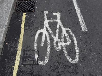 |
| Browse map: | Browse map |
# Exemption - ss_exempt
| Fieldname: | ss_exempt |
| Title: | Exemption |
| Description: | True = Exemption text present (i.e. "Except cycles") False = No exemption text |
| Data type: | ENUM('TRUE','FALSE') |
| combineOptionalField: | |
| Example ID: | RWG061578 |
| Clarifications: | Needs to be read in conjunction with other attributes, e.g. except cycles for contraflow, or cycles exempted from no right turn, etc. |
| Convert geometry: | - |
| OSM tag(s): | Needs more detailed analysis. May be possible to ignore as other fields e.g. ss_noleft may cover |
| OSM comment: | - |
| Action note: | Probably discard |
| query: | - |
| OSM Wiki page: | - |
| Documentation: | TfL documentation for ss_exempt |
| Example image: | 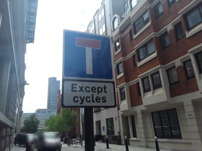 |
| Browse map: | Browse map |
# Compulsory Turn Left Exception - ss_left
| Fieldname: | ss_left |
| Title: | Compulsory Turn Left Exception |
| Description: | True = All traffic must turn left with exception False = No compulsary left turn |
| Data type: | ENUM('TRUE','FALSE') |
| combineOptionalField: | 1 |
| Example ID: | RWG060538 |
| Clarifications: | Cycles are exempted from the required left turn |
| Convert geometry: | node->relation |
| OSM tag(s): | TRUE: restriction=only_left_turn, except=bicycle |
| OSM comment: | In theory may not always be required if the target street is cycle-only, as the turn ban is in practice implemented by routers; purpose of restriction could b either (1a) to ban motors turning or (b) to indicate the target street has no motor provision. |
| Action note: | Ideally perform additional check for target street to be marked as e.g. cycleway, but this will not always be the case. |
| query: | - |
| OSM Wiki page: | Relation:restriction |
| Documentation: | TfL documentation for ss_left |
| Example image: | 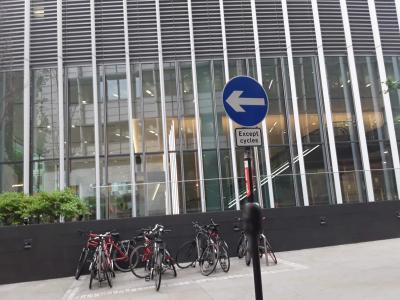 |
| Browse map: | Browse map |
# No Straight Ahead Exception - ss_noexce
| Fieldname: | ss_noexce |
| Title: | No Straight Ahead Exception |
| Description: | True = Banned straight ahead movement with exception False = Straight ahead movement not banned |
| Data type: | ENUM('TRUE','FALSE') |
| combineOptionalField: | 1 |
| Example ID: | RWG059800 |
| Clarifications: | Cycles are exempted from the required straight ahead |
| Convert geometry: | node->relation |
| OSM tag(s): | TRUE: restriction=only_straight_on, except=bicycle |
| OSM comment: | In theory may not always be required if the target street is cycle-only, as the turn ban is in practice implemented by routers; purpose of restriction could b either (1a) to ban motors turning or (b) to indicate the target street has no motor provision. S |
| Action note: | Ideally perform additional check for target street to be marked as e.g. cycleway, but this will not always be the case. |
| query: | - |
| OSM Wiki page: | Relation:restriction |
| Documentation: | TfL documentation for ss_noexce |
| Example image: | 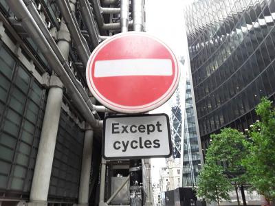 |
| Browse map: | Browse map |
# No Left Turn Exception - ss_noleft
| Fieldname: | ss_noleft |
| Title: | No Left Turn Exception |
| Description: | True = Banned left turn with exception False = No banned left turn |
| Data type: | ENUM('TRUE','FALSE') |
| combineOptionalField: | 1 |
| Example ID: | RWG059266 |
| Clarifications: | Cycles are exempted from the banned left turn |
| Convert geometry: | node->relation |
| OSM tag(s): | TRUE: restriction=no_left_turn, except=bicycle |
| OSM comment: | In theory may not always be required if the target street is cycle-only, as the turn ban is in practice implemented by routers; purpose of restriction could b either (1a) to ban motors turning or (b) to indicate the target street has no motor provision. |
| Action note: | Ideally perform additional check for target street to be marked as e.g. cycleway, but this will not always be the case. |
| query: | - |
| OSM Wiki page: | Relation:restriction |
| Documentation: | TfL documentation for ss_noleft |
| Example image: | 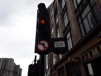 |
| Browse map: | Browse map |
# No Right Turn Exception - ss_norigh
| Fieldname: | ss_norigh |
| Title: | No Right Turn Exception |
| Description: | True = Banned right turn with exception False = No banned right turn |
| Data type: | ENUM('TRUE','FALSE') |
| combineOptionalField: | 1 |
| Example ID: | RWG061290 |
| Clarifications: | Cycles are exempted from the banned right turn |
| Convert geometry: | node->relation |
| OSM tag(s): | TRUE: restriction=no_right_turn, except=bicycle |
| OSM comment: | In theory may not always be required if the target street is cycle-only, as the turn ban is in practice implemented by routers; purpose of restriction could b either (1a) to ban motors turning or (b) to indicate the target street has no motor provision. |
| Action note: | Ideally perform additional check for target street to be marked as e.g. cycleway, but this will not always be the case. |
| query: | - |
| OSM Wiki page: | Relation:restriction |
| Documentation: | TfL documentation for ss_norigh |
| Example image: | 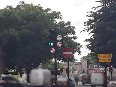 |
| Browse map: | Browse map |
# Compulsory Turn Right exception - ss_right
| Fieldname: | ss_right |
| Title: | Compulsory Turn Right exception |
| Description: | True = All traffic must turn right with exception False = No compulsary right turn |
| Data type: | ENUM('TRUE','FALSE') |
| combineOptionalField: | 1 |
| Example ID: | RWG061265 |
| Clarifications: | Cycles are exempted from the required right turn |
| Convert geometry: | node->relation |
| OSM tag(s): | TRUE: restriction=only_right_turn, except=bicycle |
| OSM comment: | In theory may not always be required if the target street is cycle-only, as the turn ban is in practice implemented by routers; purpose of restriction could b either (1a) to ban motors turning or (b) to indicate the target street has no motor provision. |
| Action note: | Ideally perform additional check for target street to be marked as e.g. cycleway, but this will not always be the case. |
| query: | - |
| OSM Wiki page: | Relation:restriction |
| Documentation: | TfL documentation for ss_right |
| Example image: | 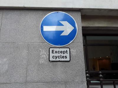 |
| Browse map: | Browse map |
# Circular Sign (if true) or Rectangular Sign (if false) - ss_circ
| Fieldname: | ss_circ |
| Title: | Circular Sign (if true) or Rectangular Sign (if false) |
| Description: | True = Circular False = Rectangular |
| Data type: | ENUM('TRUE','FALSE') |
| combineOptionalField: | |
| Example ID: | RWG063803 |
| Clarifications: | - |
| Convert geometry: | - |
| OSM tag(s): | - |
| OSM comment: | Not useful |
| Action note: | Discard |
| query: | - |
| OSM Wiki page: | - |
| Documentation: | TfL documentation for ss_circ |
| Example image: | 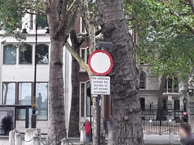 |
| Browse map: | Browse map |
# Colour of Patch - ss_colour
| Fieldname: | ss_colour |
| Title: | Colour of Patch |
| Description: | Colour of road marking patch |
| Data type: | ENUM('NONE','GREEN','RED','BLUE','BUFF/YELLOW','OTHER') |
| combineOptionalField: | |
| Example ID: | RWG053112 |
| Clarifications: | Patch around the sign |
| Convert geometry: | - |
| OSM tag(s): | - |
| OSM comment: | Not useful |
| Action note: | Discard |
| query: | - |
| OSM Wiki page: | - |
| Documentation: | |
| Example image: | 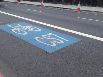 |
| Browse map: | Browse map |
# Destination - ss_destn
| Fieldname: | ss_destn |
| Title: | Destination |
| Description: | True = Direction sign False = Advisory sign |
| Data type: | ENUM('TRUE','FALSE') |
| combineOptionalField: | |
| Example ID: | RWG040960 |
| Clarifications: | - |
| Convert geometry: | - |
| OSM tag(s): | - |
| OSM comment: | Not useful. |
| Action note: | Discard |
| query: | - |
| OSM Wiki page: | - |
| Documentation: | TfL documentation for ss_destn |
| Example image: | 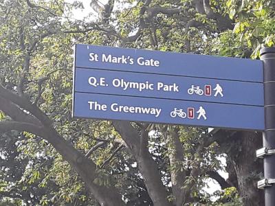 |
| Browse map: | Browse map |
# Delineating Line on Sign - ss_lnsign
| Fieldname: | ss_lnsign |
| Title: | Delineating Line on Sign |
| Description: | True = Delineating line False = Delineating sign not present |
| Data type: | ENUM('TRUE','FALSE') |
| combineOptionalField: | |
| Example ID: | RWG075567 |
| Clarifications: | - |
| Convert geometry: | - |
| OSM tag(s): | - |
| OSM comment: | Not useful. |
| Action note: | Discard |
| query: | - |
| OSM Wiki page: | - |
| Documentation: | TfL documentation for ss_lnsign |
| Example image: |  |
| Browse map: | Browse map |
# TSRGD Sign Number - ss_name
| Fieldname: | ss_name |
| Title: | TSRGD Sign Number |
| Description: | Sign number, e.g. 956.1, 953.1A, |
| Data type: | VARCHAR(50) |
| combineOptionalField: | |
| Example ID: | RWG063442 |
| Clarifications: | Needs further detailed work during implementation, but generally seems to duplicate other data, e.g. adjacent path data |
| Convert geometry: | - |
| OSM tag(s): | - |
| OSM comment: | Further investigation needed but likely to be best to discard. Signs can be represented using e.g. traffic_sign=GB:960.1, but does the OSM community want 118,893 signage locations? Very few signage locations currently, but e.g. https://www.openstreetmap.o |
| Action note: | Probably discard |
| query: | - |
| OSM Wiki page: | Key:traffic_sign |
| Documentation: | TfL documentation for ss_name |
| Example image: | 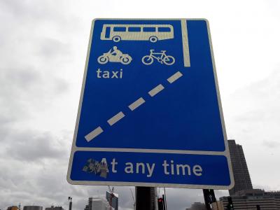 |
| Browse map: | Browse map |
# No Cycling - ss_nocyc
| Fieldname: | ss_nocyc |
| Title: | No Cycling |
| Description: | True = Sign prohibiting cycling (No Cycling) False = Sign not prohibiting cycling |
| Data type: | ENUM('TRUE','FALSE') |
| combineOptionalField: | |
| Example ID: | RWG062919 |
| Clarifications: | - |
| Convert geometry: | node->way |
| OSM tag(s): | TRUE: bicycle=dismount |
| OSM comment: | Useful |
| Action note: | Pre-associate with the relevant highway way(s) then discard the node itself |
| query: | Why does RWG062919 state restriction but there is no line under "Restricted route" |
| OSM Wiki page: | Key:access#Access_tag_values |
| Documentation: | TfL documentation for ss_nocyc |
| Example image: | 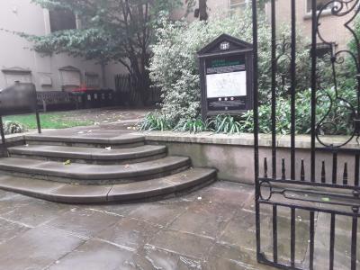 |
| Browse map: | Browse map |
# No Vehicles - ss_noveh
| Fieldname: | ss_noveh |
| Title: | No Vehicles |
| Description: | True = No vehicles except pedal cycles pushed False = Sign not prohibiting vehicles |
| Data type: | ENUM('TRUE','FALSE') |
| combineOptionalField: | |
| Example ID: | RWG063862 |
| Clarifications: | (1) By contrast to ss_nocyc, this example has associated restriction, e.g. sign RWG063862 relates to Restricted route RWG153136. (2) Has been used for Pedestrian zone in RWG063862; additional access information is present but needs to be considered in con |
| Convert geometry: | node->way |
| OSM tag(s): | TRUE: access=no, bicycle=yes, foot=yes |
| OSM comment: | Useful |
| Action note: | Pre-associate with the relevant highway way(s) then discard the node itself |
| query: | - |
| OSM Wiki page: | Key:access |
| Documentation: | TfL documentation for ss_noveh |
| Example image: | 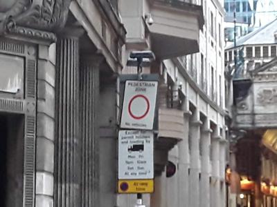 |
| Browse map: | Browse map |
# Number in a Box - ss_nrcol
| Fieldname: | ss_nrcol |
| Title: | Number in a Box |
| Description: | True = Yes a number in a box is present False = Number is box isn't present |
| Data type: | ENUM('TRUE','FALSE') |
| combineOptionalField: | |
| Example ID: | RWG076510 |
| Clarifications: | Is about typographic arrangement. Route number will be present separately in the data. |
| Convert geometry: | - |
| OSM tag(s): | - |
| OSM comment: | Not useful. |
| Action note: | Discard |
| query: | - |
| OSM Wiki page: | - |
| Documentation: | TfL documentation for ss_nrcol |
| Example image: |  |
| Browse map: | Browse map |
# Coloured Patch on Surface - ss_patch
| Fieldname: | ss_patch |
| Title: | Coloured Patch on Surface |
| Description: | True = Marking/symbol on coloured background patch False = No colour |
| Data type: | ENUM('TRUE','FALSE') |
| combineOptionalField: | |
| Example ID: | RWG063614 |
| Clarifications: | Relates only to a background colouring of the sign itself, and is not about e.g. cycleway colour |
| Convert geometry: | - |
| OSM tag(s): | - |
| OSM comment: | Not useful |
| Action note: | Discard |
| query: | - |
| OSM Wiki page: | - |
| Documentation: | TfL documentation for ss_patch |
| Example image: | 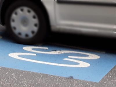 |
| Browse map: | Browse map |
# Route Number - ss_routen
| Fieldname: | ss_routen |
| Title: | Route Number |
| Description: | Number of route |
| Data type: | VARCHAR(255) |
| combineOptionalField: | |
| Example ID: | RWG040961 |
| Clarifications: | - |
| Convert geometry: | node->way/relation |
| OSM tag(s): | TRUE: ref= |
| OSM comment: | Very likely indeed to be present already as is high-profile data. |
| Action note: | - |
| query: | - |
| OSM Wiki page: | Cycle_routes#Relations |
| Documentation: | TfL documentation for ss_routen |
| Example image: | 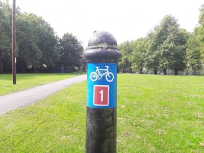 |
| Browse map: | Browse map |
# Access Times - ss_access
| Fieldname: | ss_access |
| Title: | Access Times |
| Description: | Times route is accessible (either exact times or description) |
| Data type: | VARCHAR(255) |
| combineOptionalField: | |
| Example ID: | RWG011196 |
| Clarifications: | Duplicates adjacent lane data in clt_access |
| Convert geometry: | - |
| OSM tag(s): | - |
| OSM comment: | Better to use the lane data in clt_access as that is more closely associated with geometry |
| Action note: | Discard |
| query: | - |
| OSM Wiki page: | Key:opening_hours |
| Documentation: | TfL documentation for ss_access |
| Example image: | 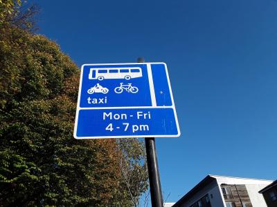 |
| Browse map: | Browse map |
# Facing Off-side - ss_facing
| Fieldname: | ss_facing |
| Title: | Facing Off-side |
| Description: | True = Facing oncoming traffic but on off-side (i.e. right) False = Not facing oncoming traffic |
| Data type: | ENUM('TRUE','FALSE') |
| combineOptionalField: | |
| Example ID: | RWG063413 |
| Clarifications: | Relates only to physical angling of a sign |
| Convert geometry: | - |
| OSM tag(s): | - |
| OSM comment: | Not useful |
| Action note: | Discard |
| query: | - |
| OSM Wiki page: | - |
| Documentation: | TfL documentation for ss_facing |
| Example image: | 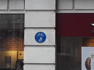 |
| Browse map: | Browse map |
# Signal fields
| Name: | Signal |
| Geometry type: | Point |
| Description: | Traffic signals at which there are specific benefits for cyclists, which includes signals that have been designed or reprogrammed so that the phasing gives advantage to cyclists and improves their safety moving through the junction. |
| Browse map: | Browse map |
| Fields: |
# Early Release - sig_early
| Fieldname: | sig_early |
| Title: | Early Release |
| Description: | True = Early release for cyclists False = No early release for cyclists |
| Data type: | ENUM('TRUE','FALSE') |
| combineOptionalField: | |
| Example ID: | RWG070836 |
| Clarifications: | - |
| Convert geometry: | - |
| OSM tag(s): | TRUE: traffic_signals:bicycle_early_release=yes |
| OSM comment: | Currently no support for this but may be useful in improving cycle safety in routing. Suggested new tag. |
| Action note: | Community consultation needed for proposed new tag |
| query: | - |
| OSM Wiki page: | Tag:highway:traffic_signals |
| Documentation: | TfL documentation for sig_early |
| Example image: | 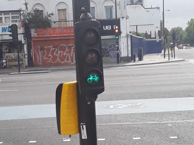 |
| Browse map: | Browse map |
# Cycle/Bus Gate - sig_gate
| Fieldname: | sig_gate |
| Title: | Cycle/Bus Gate |
| Description: | True = Cycle/bus gate allowing cycles to get ahead of general traffic False = Not a cycle/bus gate |
| Data type: | ENUM('TRUE','FALSE') |
| combineOptionalField: | |
| Example ID: | RWG064212 |
| Clarifications: | Essentially this is a physically-separate section of cycleway/busway |
| Convert geometry: | node->way |
| OSM tag(s): | TRUE: highway=cycleway, cycleway=track/share_busway |
| OSM comment: | Needs to be drawn on as additional cycleway as is physically separate. Whether to use track/share_busway needs observation of photos. |
| Action note: | - |
| query: | - |
| OSM Wiki page: | Tag:highway:cycleway |
| Documentation: | TfL documentation for sig_gate |
| Example image: | 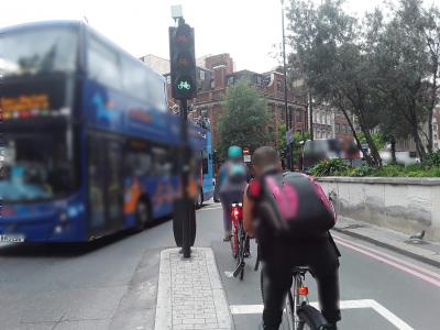 |
| Browse map: | Browse map |
# Cycle Signal Head - sig_head
| Fieldname: | sig_head |
| Title: | Cycle Signal Head |
| Description: | True = Cycle symbol on signal (as a light or set of lights with symbols) False = No cycle symbol on signal |
| Data type: | ENUM('TRUE','FALSE') |
| combineOptionalField: | |
| Example ID: | RWG150919 |
| Clarifications: | This is about physical presence of a cycle symbol, but only sometimes about head-height signals per se - can just be a filter on a general traffic light set |
| Convert geometry: | - |
| OSM tag(s): | - |
| OSM comment: | Not useful - essentially duplicates other provision e.g. signal on separate cycle track, and OSM is not really concerned with signal phasing issues. |
| Action note: | - |
| query: | - |
| OSM Wiki page: | Tag:highway:traffic_signals |
| Documentation: | TfL documentation for sig_head |
| Example image: | 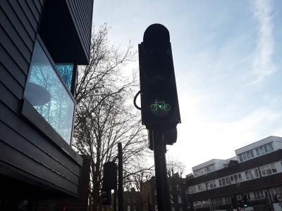 |
| Browse map: | Browse map |
# Separate Stage for Cyclists - sig_separa
| Fieldname: | sig_separa |
| Title: | Separate Stage for Cyclists |
| Description: | True = Separate stage for cyclists False = No separate stage for cyclists |
| Data type: | ENUM('TRUE','FALSE') |
| combineOptionalField: | |
| Example ID: | RWG012274 |
| Clarifications: | This is about a separate stage in timing terms but not early release |
| Convert geometry: | - |
| OSM tag(s): | - |
| OSM comment: | Not useful - essentially duplicates other provision e.g. signal on separate cycle track, and OSM is not really concerned with signal phasing issues. |
| Action note: | - |
| query: | - |
| OSM Wiki page: | Tag:highway:traffic_signals |
| Documentation: | TfL documentation for sig_separa |
| Example image: | 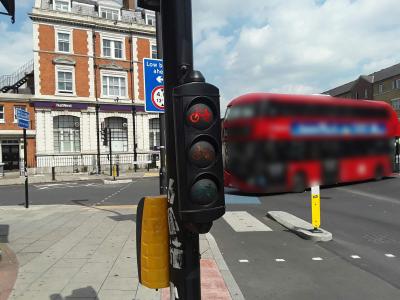 |
| Browse map: | Browse map |
# Two Stage Turn - sig_twostg
| Fieldname: | sig_twostg |
| Title: | Two Stage Turn |
| Description: | True = Two stage right turn (where signed) False = No two stage right turn (where signed) |
| Data type: | ENUM('TRUE','FALSE') |
| combineOptionalField: | |
| Example ID: | RWG070837 |
| Clarifications: | This is actually a signage addition within the lights, rather than signals per se, e.g. "No right turn -- Except in two stages" |
| Convert geometry: | node->way |
| OSM tag(s): | TRUE: highway=cycleway, bicycle:oneway=yes added as short spur after lights. Could be expressed as relation also, with except=bicycle |
| OSM comment: | Also useful for general mapping of turn restrictions, e.g. RWG070837 and nearby locations. |
| Action note: | Needs community discussion as is complex case. |
| query: | - |
| OSM Wiki page: | Conditional_restrictions |
| Documentation: | TfL documentation for sig_twostg |
| Example image: | 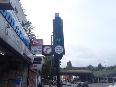 |
| Browse map: | Browse map |
# Traffic Calming fields
| Name: | Traffic Calming |
| Geometry type: | Point |
| Description: | Traffic calming measures that are intended to reduce the speed of motor vehicles. It generally comprises vertical and horizontal deflections. Traffic calming assets were recorded for on-carriageway features. For example, speed humps on fully segregated cycle lanes should not be captured. |
| Browse map: | Browse map |
| Fields: |
# Barrier - trf_barier
| Fieldname: | trf_barier |
| Title: | Barrier |
| Description: | True = Barrier that cyclists can pass False = No barrier |
| Data type: | ENUM('TRUE','FALSE') |
| combineOptionalField: | |
| Example ID: | RWG064505 |
| Clarifications: | - |
| Convert geometry: | - |
| OSM tag(s): | TRUE: barrier=bollard, access=no, bicycle=yes, foot=yes |
| OSM comment: | - |
| Action note: | Check whether community would prefer explicit access=no, bicycle=yes, foot=yes included, as these are explicitly known here, though they are the tag defaults |
| query: | - |
| OSM Wiki page: | Tag:barrier:bollard |
| Documentation: | TfL documentation for trf_barier |
| Example image: | 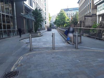 |
| Browse map: | Browse map |
# Speed Cushions - trf_cushi
| Fieldname: | trf_cushi |
| Title: | Speed Cushions |
| Description: | True = Speed cushions in line across road False = Not a speed cushions in line across road |
| Data type: | ENUM('TRUE','FALSE') |
| combineOptionalField: | |
| Example ID: | RWG065399 |
| Clarifications: | - |
| Convert geometry: | - |
| OSM tag(s): | TRUE: traffic_calming=cushion |
| OSM comment: | - |
| Action note: | - |
| query: | - |
| OSM Wiki page: | Key:traffic_calming |
| Documentation: | TfL documentation for trf_cushi |
| Example image: | 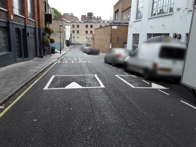 |
| Browse map: | Browse map |
# Speed Hump - trf_hump
| Fieldname: | trf_hump |
| Title: | Speed Hump |
| Description: | True = Speed hump False = Not a speed hump |
| Data type: | ENUM('TRUE','FALSE') |
| combineOptionalField: | |
| Example ID: | RWG065500 |
| Clarifications: | - |
| Convert geometry: | - |
| OSM tag(s): | TRUE: traffic_calming=hump |
| OSM comment: | - |
| Action note: | - |
| query: | - |
| OSM Wiki page: | Key:traffic_calming |
| Documentation: | TfL documentation for trf_hump |
| Example image: | 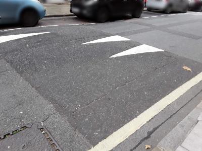 |
| Browse map: | Browse map |
# Carriageway Narrowing - trf_narow
| Fieldname: | trf_narow |
| Title: | Carriageway Narrowing |
| Description: | True = Chicane, narrowing, build-out or other horizontal deflection to traffic flow False = No carriageway narrowing |
| Data type: | ENUM('TRUE','FALSE') |
| combineOptionalField: | |
| Example ID: | RWG108673 |
| Clarifications: | If speed hump or similar is also present, will be expressed as separate asset in same location |
| Convert geometry: | - |
| OSM tag(s): | TRUE: traffic_calming=choker |
| OSM comment: | - |
| Action note: | - |
| query: | - |
| OSM Wiki page: | Key:traffic_calming |
| Documentation: | TfL documentation for trf_narow |
| Example image: | 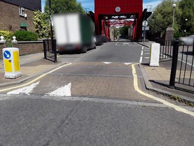 |
| Browse map: | Browse map |
# Raised Table - trf_raised
| Fieldname: | trf_raised |
| Title: | Raised Table |
| Description: | True = Raised table at junction False = Not a raised table |
| Data type: | ENUM('TRUE','FALSE') |
| combineOptionalField: | |
| Example ID: | RWG065148 |
| Clarifications: | - |
| Convert geometry: | - |
| OSM tag(s): | TRUE: traffic_calming=table |
| OSM comment: | - |
| Action note: | Locate junction node |
| query: | - |
| OSM Wiki page: | Tag:traffic_calming:table |
| Documentation: | TfL documentation for trf_raised |
| Example image: | 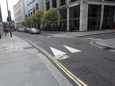 |
| Browse map: | Browse map |
# Side Road Entry Treatment - trf_entry
| Fieldname: | trf_entry |
| Title: | Side Road Entry Treatment |
| Description: | True = Side road entry treatment (raised in some way including continuous footway) False = Not a side road entry treatment |
| Data type: | ENUM('TRUE','FALSE') |
| combineOptionalField: | |
| Example ID: | RWG032637 |
| Clarifications: | - |
| Convert geometry: | Possibly node->way |
| OSM tag(s): | TRUE: sidewalk=yes, continuous=yes |
| OSM comment: | OSM currently has no notion of representing a continuous sidewalk. Could be represented on the Node as sidewalk=yes,continuous=yes, or on the Way where the pavement is separately represented. Continuous would be a new tag. If community is divided, represe |
| Action note: | Community consultation needed for proposed new tag |
| query: | - |
| OSM Wiki page: | Key:sidewalk |
| Documentation: | TfL documentation for trf_entry |
| Example image: | 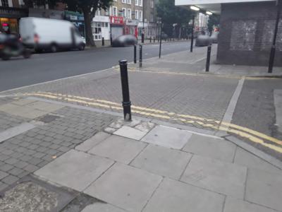 |
| Browse map: | Browse map |
# Sinusoidal - trf_sinuso
| Fieldname: | trf_sinuso |
| Title: | Sinusoidal |
| Description: | True = Hump or cushion is sinusoidal False = Not a sinusiodal hump or cushion |
| Data type: | ENUM('TRUE','FALSE') |
| combineOptionalField: | |
| Example ID: | RWG065493 |
| Clarifications: | Is a property additional to type |
| Convert geometry: | - |
| OSM tag(s): | TRUE: sinusoidal=yes |
| OSM comment: | New tag needed, additional to the traffic calming type itself |
| Action note: | Community consultation needed for proposed new tag |
| query: | - |
| OSM Wiki page: | - |
| Documentation: | TfL documentation for trf_sinuso |
| Example image: | 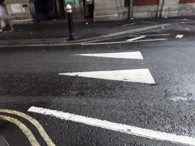 |
| Browse map: | Browse map |
# Other - trf_calm
| Fieldname: | trf_calm |
| Title: | Other |
| Description: | True = Other traffic calming measure False = No an 'other' type of traffic calming |
| Data type: | ENUM('TRUE','FALSE') |
| combineOptionalField: | |
| Example ID: | RWG135644 |
| Clarifications: | - |
| Convert geometry: | - |
| OSM tag(s): | TRUE: traffic_calming=yes |
| OSM comment: | Various random things. Could subsequently be upgraded by manual inspection of photos to more specific types. |
| Action note: | - |
| query: | - |
| OSM Wiki page: | Key:traffic_calming |
| Documentation: | TfL documentation for trf_calm |
| Example image: | 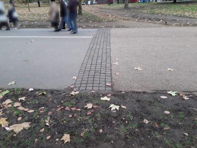 |
| Browse map: | Browse map |
# Standard fields
| Browse map: | Browse map |
| Fields: |
# Borough - borough
| Fieldname: | borough |
| Title: | Borough |
| Description: | Borough in which asset is located |
| Data type: | |
| combineOptionalField: | |
| Example ID: | |
| Clarifications: | |
| Convert geometry: | |
| OSM tag(s): | |
| OSM comment: | |
| Action note: | |
| query: | |
| OSM Wiki page: | |
| Documentation: | |
| Example image: | |
| Browse map: | Browse map |
# Feature ID - feature_id
| Fieldname: | feature_id |
| Title: | Feature ID |
| Description: | Unique ID for asset |
| Data type: | |
| combineOptionalField: | |
| Example ID: | |
| Clarifications: | |
| Convert geometry: | |
| OSM tag(s): | |
| OSM comment: | |
| Action note: | |
| query: | |
| OSM Wiki page: | |
| Documentation: | |
| Example image: | |
| Browse map: | Browse map |
# Latitude - latitude
| Fieldname: | latitude |
| Title: | Latitude |
| Description: | Geographical reference of point asset |
| Data type: | |
| combineOptionalField: | |
| Example ID: | |
| Clarifications: | |
| Convert geometry: | |
| OSM tag(s): | |
| OSM comment: | |
| Action note: | |
| query: | |
| OSM Wiki page: | |
| Documentation: | |
| Example image: | |
| Browse map: | Browse map |
# Longitude - longitude
| Fieldname: | longitude |
| Title: | Longitude |
| Description: | Geographical reference of point asset |
| Data type: | |
| combineOptionalField: | |
| Example ID: | |
| Clarifications: | |
| Convert geometry: | |
| OSM tag(s): | |
| OSM comment: | |
| Action note: | |
| query: | |
| OSM Wiki page: | |
| Documentation: | |
| Example image: | |
| Browse map: | Browse map |
# Photo1_URL - photo1_url
| Fieldname: | photo1_url |
| Title: | Photo1_URL |
| Description: | Asset photo 1 |
| Data type: | |
| combineOptionalField: | |
| Example ID: | |
| Clarifications: | |
| Convert geometry: | |
| OSM tag(s): | |
| OSM comment: | |
| Action note: | |
| query: | |
| OSM Wiki page: | |
| Documentation: | |
| Example image: | |
| Browse map: | Browse map |
# Photo2_URL - photo2_url
| Fieldname: | photo2_url |
| Title: | Photo2_URL |
| Description: | Asset photo 2 |
| Data type: | |
| combineOptionalField: | |
| Example ID: | |
| Clarifications: | |
| Convert geometry: | |
| OSM tag(s): | |
| OSM comment: | |
| Action note: | |
| query: | |
| OSM Wiki page: | |
| Documentation: | |
| Example image: | |
| Browse map: | Browse map |
# Survey Date - svdate
| Fieldname: | svdate |
| Title: | Survey Date |
| Description: | Date asset was surveyed |
| Data type: | |
| combineOptionalField: | |
| Example ID: | |
| Clarifications: | |
| Convert geometry: | |
| OSM tag(s): | |
| OSM comment: | |
| Action note: | |
| query: | |
| OSM Wiki page: | |
| Documentation: | |
| Example image: | |
| Browse map: | Browse map |